SCOUT SLAM
*In stock and ready to ship
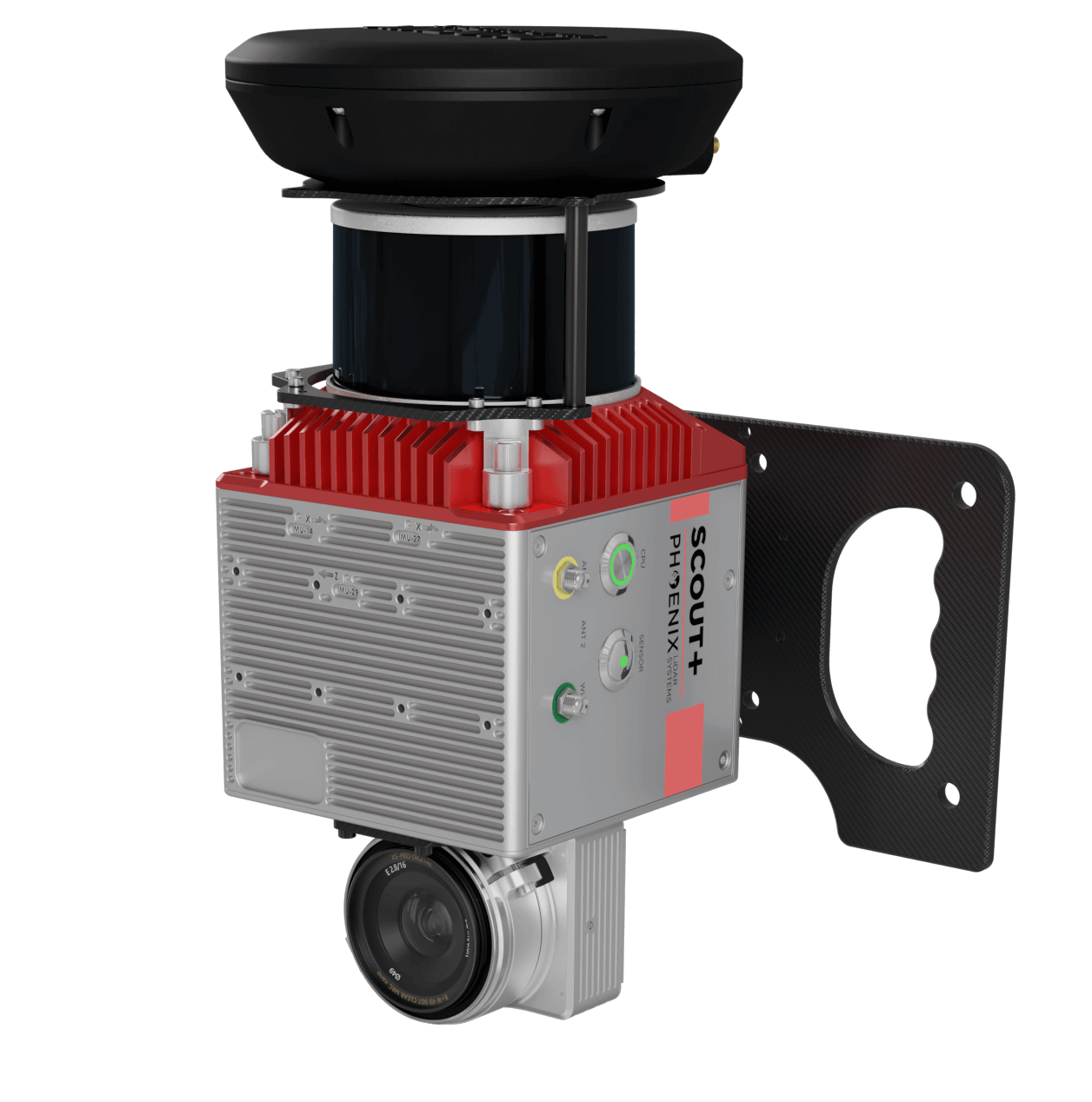
CONQUER GPS-DENIED MAPPING PROJECTS
The new SCOUT SLAM accessory kit makes LiDAR more versatile by offering a dependable tool for mapping GPS-denied environments, such as underground mines and indoors. Adapt any SCOUT series product to a handheld SCOUT SLAM system to accurately scan where others can’t!
FEATURES
-
Map indoors and in other GPS-denied environments
-
Automatic loop-closures eliminate drift
-
Manual constraints allow fine-grained control of point cloud alignment
-
Use of GPS for absolute timing, automatically georeferences the point clouds, and removes drift Weight: 2.2 kg / 4.9 lbs.
-
Ground Control Points from any source can be used to further align the point cloud to known positions.
VIEW FULL SPECIFICATIONS
Laser
905 nm
Accuracy
20 mm
Precision
15 mm
Pulse Rate
640 kHz
Returns
3
Field of View
360°
Heading Drift Rate
0.243°/hr
Recommended Max. AGL
100 m
Range @10% Reflectivity
300 m
Constellation Support
GPS, GLONASS, BEIDOU, GALILEO
Overall Dimensions
17.7 x 11.6 x 12.3 cm
Operating Voltage
12-28 VDC
Power Consumption
30 W
Weight
2.2 kg / 4.9 lbs
Operating Temperature
0 - +40° C
Primary Applications

Construction

Cultural

Mining

Civil
Primary Applications
SLAM
Custom LiDAR Solutions
Convert any Phoenix SCOUT model into a SLAM-compatible LiDAR Solution
The Phoenix SLAM makes Phoenix LiDAR products more versatile by offering a dependable tool for mapping GPS-denied environments, such as underground mines and indoors. With the addition of augmented reality glasses, any Phoenix LiDAR SCOUT series model can be converted into a SLAM-compatible solution using the on-board software, navigation system and sensor for SLAM. Additionally, the Phoenix SLAM extends previous mapping solutions by supporting hybrid mapping modes: sparse GNSS fixes before, during and after SLAM acquisition can be used to eliminate drift and properly reference data in space and time. Existing ground control points can also be tied into the solution to ensure that deliverables align with ground truth
Phoenix Software Suite
Included with all Phoenix LiDAR Systems packages
Phoenix LiDAR Systems provides a proprietary complete software suite for streamlined acquisition, geo-referencing, data fusion, export and post-processing in the cloud.

