Setting The Record Straight
November 19, 2021
Large scale multi-layer fuel load characterization in tropical savanna using GEDI spaceborne lidar data
January 1, 2022
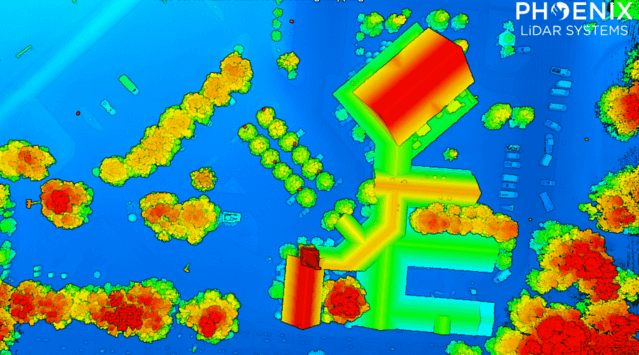
Airborne laser scanning has proven useful for rapid and extensive documentation of historic cultural landscapes after years of applications mapping natural landscapes and the built environment. The recent integration of unoccupied aerial vehicles (UAVs) with LiDAR systems is potentially transformative and offers complementary data for mapping targeted areas with high
precision and systematic study of coupled natural and human systems. [register below to download full whitepaper]
Related posts


May 19, 2023

May 19, 2023